


JACKSON - T 5 Voting District, Washington County, Wisconsin
About
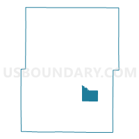
Outline

Summary
| Unique Area Identifier | 697652 |
| Name | JACKSON - T 5 Voting District |
| County | Washington County |
| State | Wisconsin |
| Area (square miles) | 6.57 |
| Land Area (square miles) | 6.57 |
| Water Area (square miles) | 0.00 |
| % of Land Area | 100.00 |
| % of Water Area | 0.00 |
| Latitude of the Internal Point | 43.29668610 |
| Longtitude of the Internal Point | -88.15398660 |
Maps


Graphs
Select a template below for downloading or customizing gragh for JACKSON - T 5 Voting District, Washington County, Wisconsin


Neighbors
Neighoring Voting District (by Name) Neighboring Voting District on the Map
- GERMANTOWN - T 1 Voting District, Washington County, WI
- Germantown - V 1 Voting District, Washington County, WI
- Germantown - V 2 Voting District, Washington County, WI
- JACKSON - T 1 Voting District, Washington County, WI
- JACKSON - T 2 Voting District, Washington County, WI
- Jackson - V 1 Voting District, Washington County, WI
- Jackson - V 2 Voting District, Washington County, WI
- Jackson - V 6 Voting District, Washington County, WI
- Jackson - V 7 Voting District, Washington County, WI
- POLK - T 6 Voting District, Washington County, WI
- POLK - T 7 Voting District, Washington County, WI
- RICHFIELD - T 10 Voting District, Washington County, WI
Top 10 Neighboring County Subdivision (by Population) Neighboring County Subdivision on the Map
- Germantown village, Washington County, WI (19,749)
- Richfield village, Washington County, WI (11,300)
- Jackson village, Washington County, WI (6,753)
- Jackson town, Washington County, WI (4,134)
- Polk town, Washington County, WI (3,937)
- Germantown town, Washington County, WI (254)
Top 10 Neighboring Place (by Population) Neighboring Place on the Map
Top 10 Neighboring Unified School District (by Population) Neighboring Unified School District on the Map
- West Bend School District, WI (51,553)
- Germantown School District, WI (25,684)
- Slinger School District, WI (15,694)
Top 10 Neighboring State Legislative District Lower Chamber (by Population) Neighboring State Legislative District Lower Chamber on the Map
- Assembly District 99, WI (63,750)
- Assembly District 58, WI (60,111)
- Assembly District 24, WI (57,065)
Top 10 Neighboring State Legislative District Upper Chamber (by Population) Neighboring State Legislative District Upper Chamber on the Map
- State Senate District 33, WI (177,499)
- State Senate District 20, WI (176,381)
- State Senate District 8, WI (165,331)
Top 10 Neighboring 111th Congressional District (by Population) Neighboring 111th Congressional District on the Map
Top 10 Neighboring Census Tract (by Population) Neighboring Census Tract on the Map
- Census Tract 4501.04, Washington County, WI (6,264)
- Census Tract 4601.01, Washington County, WI (6,262)
- Census Tract 4701, Washington County, WI (5,157)